


Alto Golfo de California y Delta del Río Colorado
Location
Baja California and Sonora, Mexico
Category
Hemispheric
Basis for Designation
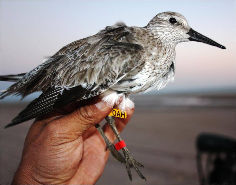
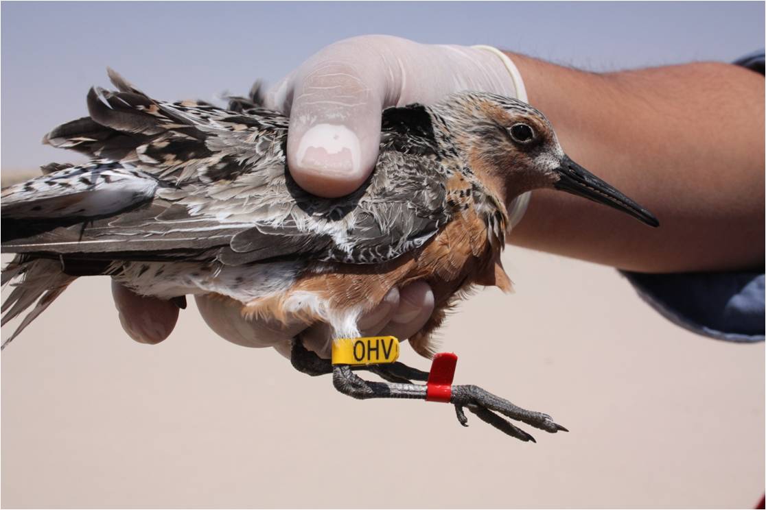
More than 6,000 Red Knots of the roselaari subspecies (Calidris canutus), 35% of the subspecies’ population.
Size
289,350 hectares (714,999 acres)
Date Designated
December 1992
Site Owner
National Commission on Natural Protected Areas (CONANP)
Site Partners
Pronatura Noroeste
Commission on Ecology and Sustainable Development of Sonora (CEDES)
Autonomous University of Baja California Sur (UABCS)
Ensenada Center for Scientific Research and Higher Education (CICESE)
University of Arizona

Overview
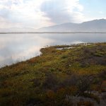
Estero Río Colorado was designated a WHSRN site of International Importance in 1992. Located in northwestern Mexico, the original site surrounded the point where the mouth of the Colorado River enters the Gulf of California containing 240,000 hectares. In September 2015 the WHSRN Hemispheric Council approved partners’ request to expand the boundaries of the Estero Rio Colorado WHSRN Site in northwest Mexico by 49,350 hectares, upgrade its category from International to Hemispheric Importance, and rename the site as “Alto Golfo de California y Delta del Río Colorado”.
The expanded 289,350-hectare WHSRN site consists of the area surrounding the Colorado River Delta plus the added 45-kilometer stretch of adjacent Sonoran coastline containing sandy beaches that host more than 6,000 Red Knots of the roselaari subspecies (Calidris canutus roselaari). This number represents 35% of the subspecies’ population, qualifying the expanded site for “Hemispheric Importance.”
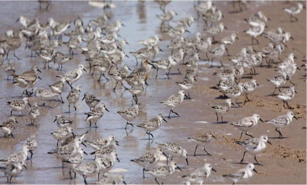
The coastline’s sandy beaches host more than 6,000 Red Knots of the roselaari subspecies, representing 35% of this subspecies’ population.
Shorebirds
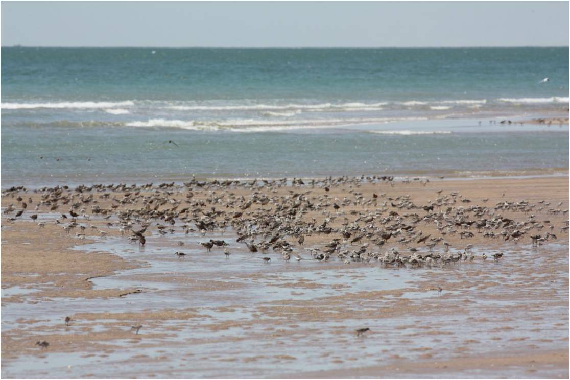
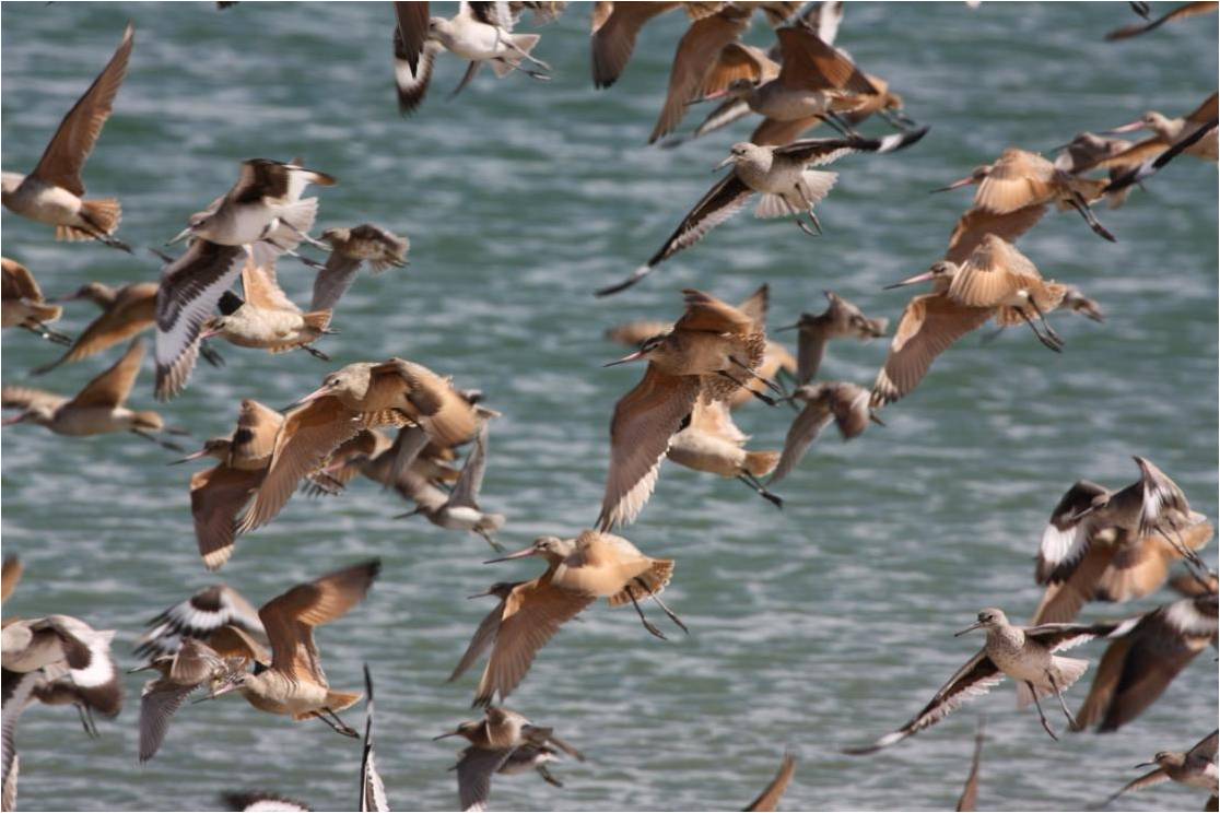
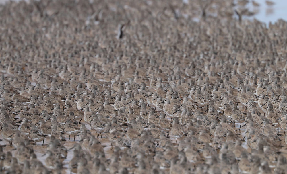
A total of 36 shorebird species have been registered in the area of the Río Colorado. The site supports more than 160,000 shorebirds annually. Most (80%) are small-size shorebirds, while 15% are large and 5% are medium-size. Most small shorebirds are Western Sandpipers (Calidris mauri) using the area of the Montague and Pelican Islands. Also on the eastern shore, modest numbers of Sanderlings (Calidris alba) are observed. Among the large shorebirds, Willet (Tringa semipalmata; approx. 8,000 birds) and Marbled Godwit (Limosa fedoa, approx. 3,000 birds) are the most common. The numbers above correspond to winter populations.
During spring migration, 6,000 to 9,000 roselaari Red Knots and 10,000 Sanderlings can be found on the sandy beaches on the south of the town of Golfo de Santa Clara, in Sonora. In the spring, Black-bellied Plover (Pluvialis squatarola), Western Sandpiper, Marbled Godwit, Willet, Surfbird (Calidris virgata) and Dunlin (Calidris alpina) are also seen in modest numbers.

Marbled Godwits (Limosa fedoa) and Willets (Tringa semipalmata). Photo: Roberto Carmona.
Other Designations
Alto Golfo de California y Delta de Rio Colorado is also recognized as a Priority Wetland for shorebirds in Mexico by the Mexican National Shorebird Conservation Strategy; an Important Bird Area (AICA 106) by Birdlife International; and three Ramsar sites (numbers 0814, 1822, and 1866).
Environment
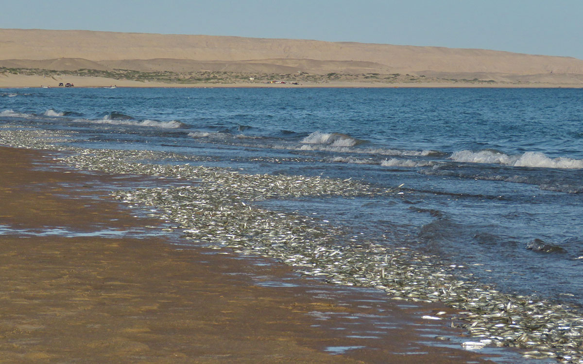
There are three major types of environments for shorebirds at Estero Río Colorado: mudflats, sandy beaches, and a brackish marsh. The most important mudflat site is in the vicinity of Montague and Pelican islands at the mouth of the Colorado River. There is also a mudflat north of the town of Golfo de Santa Clara which is extensive due to the remarkable tidal range. South of Golfo de Santa Clara the sandy beach extends about 40 km and is fringed by dunes. These beaches are the spawning areas for pejerrey (Leuresthes sardina) in spring. The eggs of this species are prized by shorebirds, so in spring this area is important for many species. Finally, the brackish marsh known as Cienega de Santa Clara, is located on the east side of the Colorado River Delta in Sonora. It covers 18,000 hectares of dense cattail marshes, lagoons and mudflats. The marsh is currently the most important wetland in the Sonoran Desert and provides important habitat for a variety of species. The Cienega de Santa Clara was dominated by extensive scrub and wetlands before construction of the Hoover Dam in the United States. Since 1975 wetlands have almost disappeared in Mexico, but brackish water originating from irrigation in the United States have restored a piece of this marsh.

Sanderlings (Calidris alba) trying to feed on a sandy beach. Photo: Roberto Carmona.
Threats
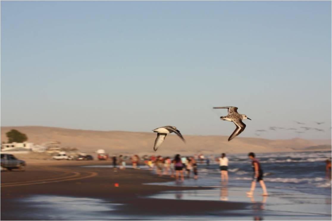
There are general threats that can cover all three environments (mudflats, sandy beaches, marshes), such as the use of agrochemicals in the surrounding agricultural areas, excessive population growth, and an increase in tourism. Specific to the Cienega de Santa Clara, the implementation of desalination plants and a decline in acreage under cultivation in Yuma could mean that the marsh will receive less water increasing its saltiness. During the spring holidays, particularly “Easter”, the sandy beaches become a tourist attraction with high traffic including beach vehicles (cars and quads) and dogs. Developments planned for these beaches, such as, golf courses and marinas could also be a future threat. The biggest threats for the mudflats involve extractive activities such as fishing and clamming.

Resources


- VIDEO by Pronatura Noroeste, A.C.: Migration and Reproduction in Synchrony: The Pejerrey and the Red Knot

Click below to read the plan to manage and conserve the sandy beach at Golfo de Santa Clara, Sonora for Gulf Grunion (Leuresthes sardina), the roselaari subspecies of Red Knot (Calidris canutus rufa), and other shorebirds.
The Bird Lab at the Autonomous University of Baja California Sur (UABCS) works for the conservation of birds in northeastern Mexico.

