


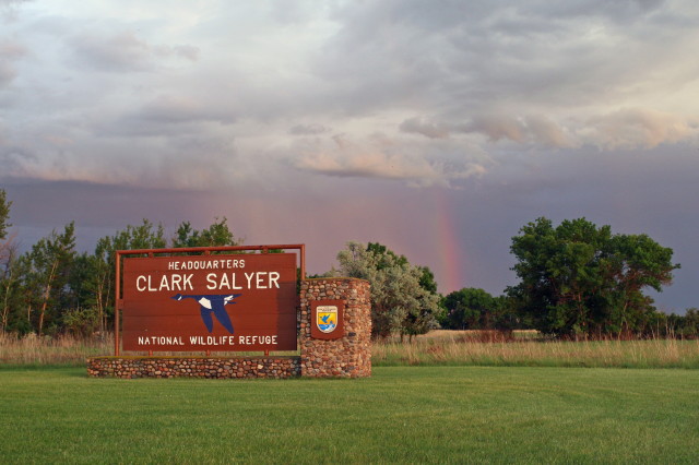
J. Clark Salyer NWR
Location
North Dakota, United States
Category
Regional
Basis for Designation
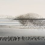
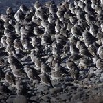
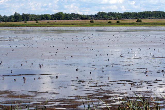
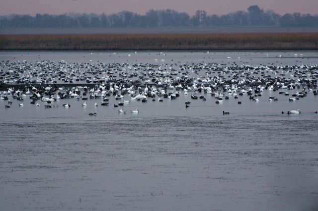
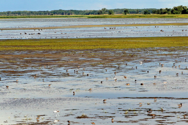
Supports more than 20,000 shorebirds annually.
Size
23,876 hectares (58,999 acres)
Date Designated
March 2001
Site Owner
U.S. Fish and Wildlife Service
Site Partners
North Dakota Fish and Game Department
Ducks Unlimited, Inc.
North Dakota Wetland Trust
Pierce County Soil Conservation District
North McHenry County Conservation District
South McHenry Soil Conservation District
Renville County Conservation District
Rolette County Soil Conservation District
Turtle Mountain Soil Conservation District
Kersten Construction, Monsanto
Bottineau County Wildlife Club
NDSU-Bottineau Wildlife Department
The Nature Conservancy
Ruffed Grouse Society
Boy Scouts
Several private landowners and volunteers

Overview
The J. Clark Salyer National Wildlife Refuge was first established as the Lower Souris National Wildlife Refuge in September 1935, and officially changed to its current name in September 1967. The primary habitat management goal is to preserve, restore, and enhance Souris River Basin habitats, which include prairie wetlands, riparian lands, and uplands. The 58,700-acre refuge in North Dakota extends 45 miles south from the Canadian (Manitoba) border. The surrounding area has an extremely flat topography and a high density of wetlands—270 or more per square mile in some areas—from having been the lake bottom of Glacial Lake Souris some 7,000-10,000 years ago. The refuge is part of the five-county, 308,000-acre Souris River Basin National Wildlife Refuge (NWR) Complex.

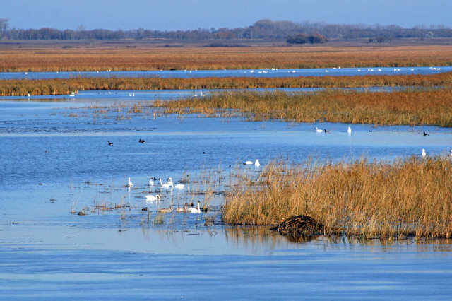
Refuge marsh at sunset. Photo: Gary Eslinger.
Habitat
The refuge is located within a northern mixed-grass prairie landscape, in the Souris River flood plain, with the following habitat composition:
- Freshwater Wetlands – 26,000 acres
- Riparian and Meadow – 8,042 acres
- Prairie Parkland (mix of prairie and woodland) – 9,579 acres
- Sandhills Prairie – 2,802 acres
- Drift Prairie (native grassland on loam soils) – 4,420 acres
- Previously farmed areas reseeded to grasses and forbs – 7,675 acres
Adjacent lands are composed of cropland (small grains and oilseed crops), Conservation Reserve Program grasslands, and native rangeland.
Climate
The semi-arid to sub-humid continental climate means long, cold winters (lows ranging from -1 to -5°F), moderately warm summers (highs in the low 80s °F), and rapidly changing weather patterns. Annual snowfall ranges from 30 to 40 inches; annual precipitation from 16.7 to 17.5 inches, with 80% occurring between April and September.
Water
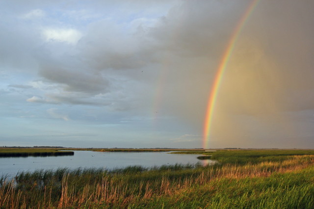
Glaciated “prairie potholes” are one of the most obvious features on the landscape. These extremely productive wetland basins have a range of water depths and permanence, from temporary, to seasonal, to semi-permanent, and lake-like. The Souris River originates in southern Saskatchewan (Canada), flows southwest to Velva, North Dakota, and then northward to join the Assiniboine River in southern Manitoba. Some 75 miles of this river flow through the refuge.
Dikes with water-control structures have created over 23,000 acres of open water, marsh, and wet-meadow habitat for migratory birds.
Land Use
Settlement of the area by Europeans began during the late 1800s and during the next 40 years significant prairie and wetland resources were plowed and drained for agricultural production. The J. Clark Salyer Refuge is dedicated to the maintenance of habitats and wildlife populations representative of the area prior to such settlement. The refuge receives approximately 15,000 visits annually. Up to 40% of the visits are for nature interpretation, wildlife observation (May – October), and environmental education; the balance primarily for hunting and fishing. During the past 10 years there has been a steady increase in birding at the refuge, and it is now among the primary stops for birders in or visiting North Dakota.

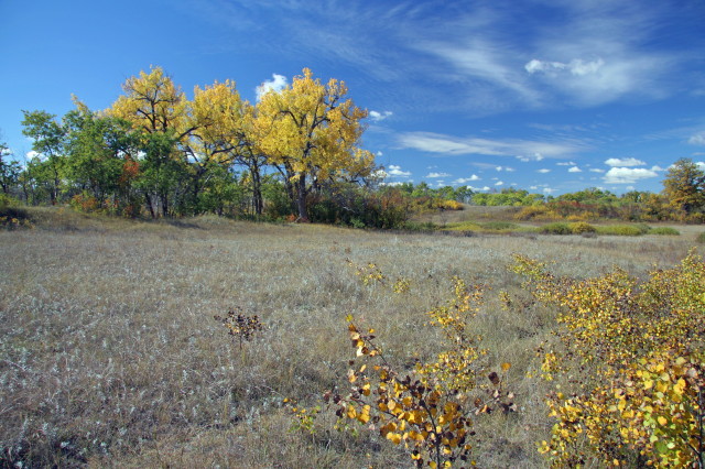
Riparian woodlands along the Souris River. Photo: Gary Eslinger.
Current Threats
The reconstruction of two dams in the Upper Souris River Basin in Saskatchewan and the completion of a flood-control project to protect Minot, ND, have altered the hydrology and hydro-period of the historically free-flowing river system. Peak spring river flows (March-April) are now reduced in volume and extended in duration (late June). The ability to drawdown riverine wetlands, a critical process for maintaining long-term wetland productivity, is also reduced.
The refuge is federally protected, but continued conversion of grasslands/wetlands for agricultural production adjacent to its borders poses a threat to the water resources within. Nonpoint-source pollution and sedimentation from adjacent agriculture lands are a continuing concern for water quality throughout the North Dakota portion of the Souris River Basin.
Management and Research Activities
The refuge completed its 15-year Comprehensive Conservation Plan (CCP) in 2007. Managers followed specific criteria and objectives to identify areas of highest priority for restoration, akin to a ‘triage’ approach. Specifically, they seek to restore those ecological processes that will best sustain the long-term productivity of wetland habitats and, in turn, the diverse plant and wildlife communities representative of the Northern Great Plains region. Watershed-level efforts will aim to reduce sedimentation and nonpoint-source pollution to benefit riverine marshes.
Drawdowns of water are likely to be more frequent under the CCP’s new management approach than in the past, to the benefit of shorebirds. However, per the CCP’s triage approach, no additional monitoring is planned for estimating shorebird populations or their response to wetland management. Unpredictable shorebird use in the Prairie Pothole Region combined with the vast and complex configuration of the refuge’s marsh units requires far more financial and human resources than are available for gathering meaningful population data.

Resources

Comprehensive Conservation Plan
The comprehensive conservation plan sets the management and use of Des Lacs, J. Clark Salyer, and Upper Souris national wildlife refuges for 15 years.

