


Fraser River Estuary
Location
British Columbia, Canada
Category
Hemispheric
Basis for Designation
>500,000 shorebirds in spring migration.
Size
31,648 hectares (78,204 acres)
Date Designated
April 2005
Site Owner
Canadian Wildlife Service
Ministry of Forests, Lands, Natural Resource Operations and Rural Development
Site Partners
Canadian Wildlife Service
Ministry of Forests, Lands, Natural Resource Operations and Rural Development
Centre for Wildlife Ecology at Simon Fraser University
City of Richmond, British Columbia
City of Surrey, British Columbia
Municipality of Delta, British Columbia
Greater Vancouver Regional District
Federation of BC Naturalists
Nature Trust of British Columbia
Friends of Semiahmoo Bay
Vancouver Natural History Society
Boundary Bay Conservation Committee
Pacific Birds Habitat Joint Venture
Nature Canada
Nature Conservancy of Canada
Bird Studies Canada

Overview
The Fraser River begins high in the Rocky Mountains of Canada and 1300 kilometers later it spills into the Pacific Ocean near Vancouver in southwest British Columbia. The river’s wide delta attracts millions of migrating birds annually making the Fraser River estuary a premier bird habitat in Canada.
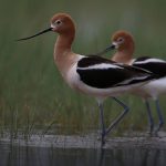
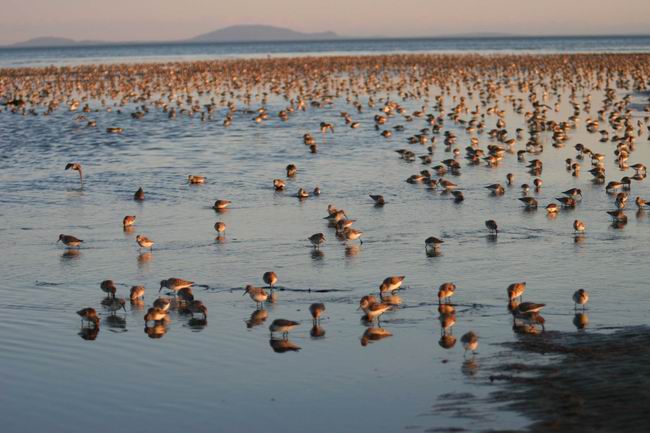
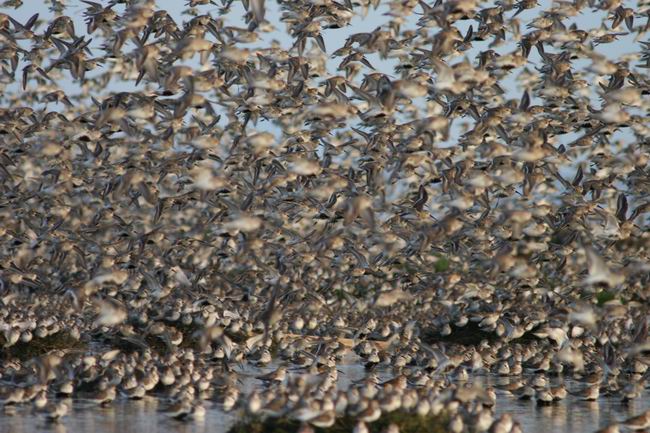
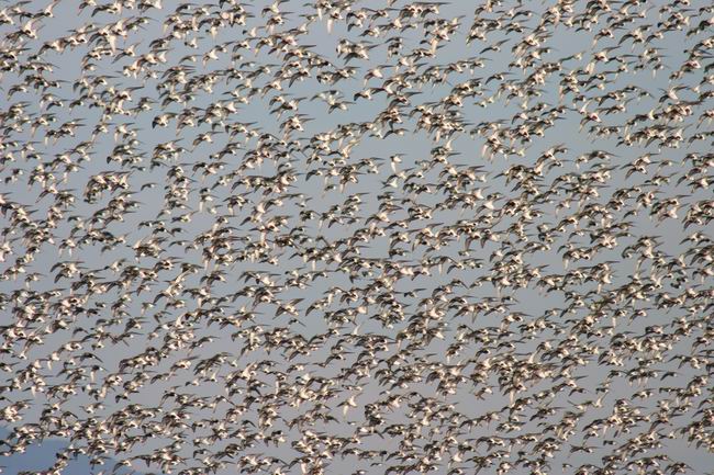
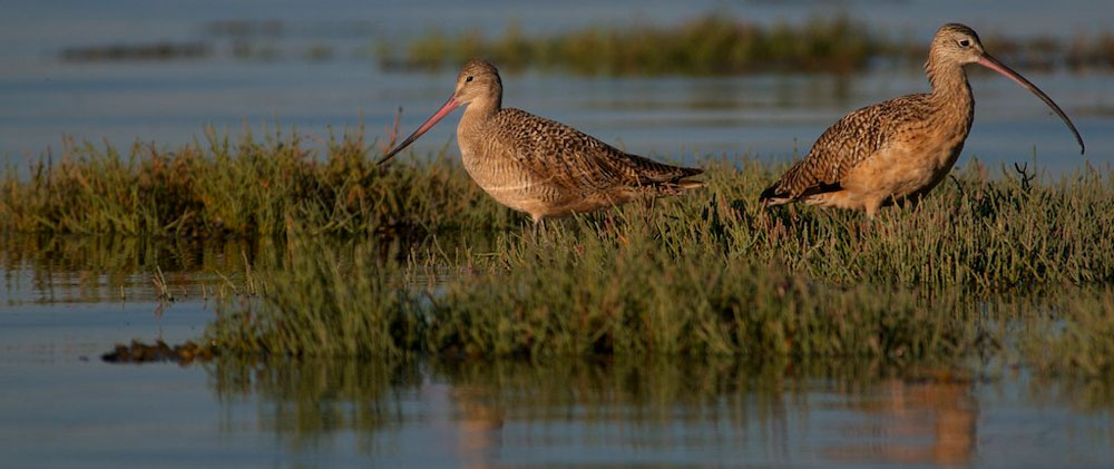
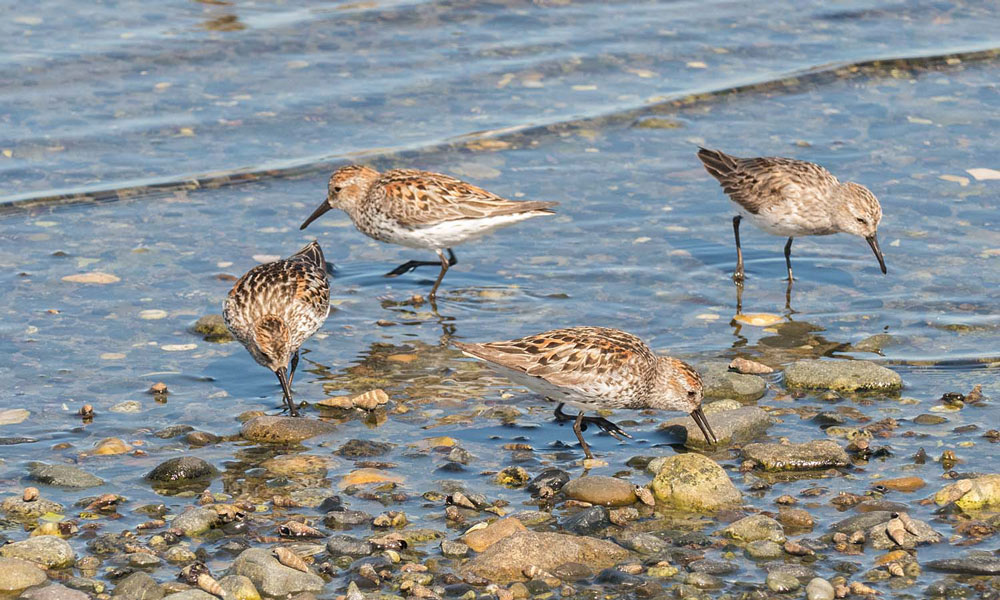
Several million shorebirds pass over the estuary each year in migration and tens of thousands remain in the winter. The mudflats on Roberts Bank in the centre of the estuary harbor the greatest number of shorebirds. Over 500,000 Western Sandpipers have been estimated to use the mudflat on a single day in spring migration. The mudflats are many kilometers wide during low tide. The mud teams with tiny invertebrates – in some places over 1000 invertebrates have been tallied in a 10 cm diameter core of mud. And on the surface, tiny diatoms and bacteria coat the mud in a greenish hue that western sandpiper dab from the surface with specialized tongues. In the marshes, dowitchers probe for marine worms and yellowlegs dart after small fish. On the sandflats, black-bellied plovers and dunlins pursue marine worms.
High tides push the birds towards the marsh edges and falcons that prey on them. Some dunlins form into tight bundled flocks making hunting difficult for falcons while others join black-bellied plovers in adjacent cultivated fields to seek out terrestrial insects and worms. No month goes by when shorebirds are not on the delta.
Over 500,000 Western Sandpipers have been estimated to use the mudflat on a single day in spring migration.
Habitat Description
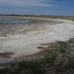
The Fraser River estuary is nearly 32,000 ha of intertidal mud and sandflats. The delta includes these intertidal habitats plus cultivated farmlands and suburban and industrial developments behind dykes. The importance of the Fraser River delta is well known to Canadians as a key bird and fish habitat and conservation agencies and organizations have secured many key places for them. The intertidal areas boast various designations listed below. Large bogs have been purchased and the mostly privately owned agricultural lands are maintained for farming uses under legislation. Boundary Bay along the southernmost shore and Sturgeon Banks along the northwest shore, and the South Arm Marshes in the Fraser River mouth are Provincial Wildlife Management Areas. Alaksen National Wildlife Area on Roberts Bank in the center of the estuary is a Ramsar Wetland of International Importance. The George C. Refiel Migratory Bird Sanctuary offers a small amount of protection to some marshes on Roberts Bank. And the entire delta is an Important Bird Area with the greatest combined total number of global, continental and national species in Canada. The WHSRN designation applies to the intertidal portions of the entire estuary and upriver to the South Arm marshes.

Shorebird flock in flight at the Fraser River Estuary. Photo: Rob Butler.
Land Use
The intertidal beaches in the Fraser River estuary are largely unused by humans. The exceptions are sand beaches on the east and west shores of Boundary Bay, and on Iona Island on Roberts Bank that are used by sunbathers, swimmers and windsurfers, and two large port developments on Roberts Bank. The British Columbia ferry corporation operates a major ferry terminal and the Vancouver Port Authority operates a coal port and container ship facility on southern Roberts Bank. The delta land behind dikes is home to hundreds of thousands of British Columbians who reside in houses in the Cities of Richmond and Surrey, and Municipality of Delta. Much of the land is cultivated for vegetable crops, pasture and berry crops, and increasingly covered in greenhouses. Freighters, coastal ships and recreational boats ply the Fraser River to docks along the river.
Habitat Protection
The various provincial, national and international designations provide several layers of protection to the habitats. In addition, the British Columbia Wildlife Act and the federal Migratory Bird Convention Act provide some protection to the birds. Seasonal hunting is permitted in some areas and strictly controlled in the estuary.
Impacts and Disturbance
Recreational use of the estuary is growing as more people emigrate to Vancouver. Wind surfing, sail boarding and jet skiing disturbance is localized at the moment. However, conflicts between the conservation and educational uses of estuary will likely continue to grow.

Threats
Much of the estuary is protected for wildlife use under various jurisdictions. The greatest threats is to the important shorebird habitat on Roberts Bank where port expansion projects will cover some mudflat habitats. The port authorities have responded to environmental concerns through mitigation and adaptive management proposals to environmental agencies.
Management Priorities
The British Columbia government drafted habitat management plans for Boundary Bay, Roberts Bank and Sturgeon Banks. A priority will be to minimize the impact of port development to the shorebird habitat.
Resources

Fraser Delta, Jewel of the Pacific Flyway
Click to enlarge infographic.


