


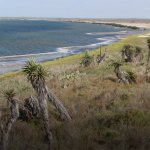
Rainwater Basin
Location
Nebraska, United States
Category
Hemispheric
Basis for Designation
Stopover for nearly 100% of the hemisphere’s migrating Buff-breasted Sandpipers (Calidris subruficollis) during spring. Playa wetlands also support more than 300,000 other shorebirds.
Size
1,590,795 hectares (3,930,934 acres)
Date Designated
February 2009
Site Owner
U.S. Fish and Wildlife Service
Nebraska Game and Parks Commission
Ducks Unlimited
Natural Resource Conservation Service
Site Partners
Rainwater Basin Joint Venture

Overview
The 3.9 million-acre Rainwater Basin lies in the center of the United States, in south-central Nebraska, and just south of the Platte River. It is a critical stopover site for numerous bird species that migrate through the continent’s interior. February and March bring the spectacle of millions of Snow Geese; some flocks are so dense, they nearly obscure the sky above a wetland. Hundreds of thousands of Mallards, Northern Pintails, Greater White-fronted Geese and other waterfowl soon follow. The basins are an important habitat for the critically-endangered Whooping Crane during migration. Hundreds of thousands of migrating shorebirds stop here to feed and rest. Forty species have been recorded, including significant numbers of White-rumped Sandpipers, Stilt Sandpipers, Long-billed Dowitchers, Hudsonian Godwits, Wilson’s Phalaropes, and American Golden-Plovers. Recent research indicates that the eastern Rainwater Basin is the mid-continent’s only identified major stopover for the Buff-breasted Sandpiper.
Physical and Ecological Features
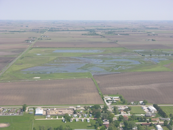
The region is a relatively flat to gently rolling landscape that totals approximately 10,000 square kilometers. It was historically a tall- to mid-grass prairie plain containing nearly 12,000 playa wetlands that covered over 200,000 acres. Rainwater Basin wetlands vary in size, from less than an acre, up to 1,000 acres. These shallow wetlands are lined with a nearly impervious layer of clay and fed by precipitation – mostly melting snow and spring rains. Climate patterns on the Great Plains are variable, and water levels in the Rainwater Basin are highly dynamic. It is not unusual for a wetland to go dry for months, or occasionally longer, only to fill again when weather patterns change. Rich soils, ample food base, and dynamic conditions combine to make these wetlands critically important wildlife habitat.

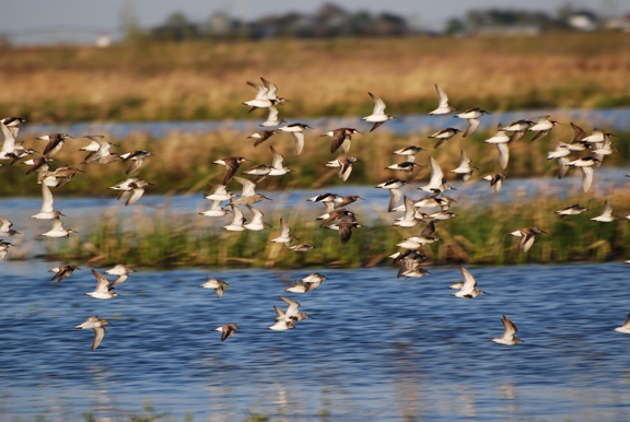
Long-billed Dowitchers in flight. Photo: Joel Jorgensen.
Land Use
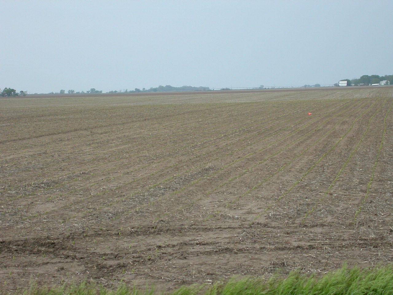
During late 19th century and throughout the 20th century, the Rainwater Basin landscape was converted to irrigated row-crop agriculture. Today, more than 90 percent of the region’s wetlands have been destroyed, and over 80 percent of the land area is devoted to agriculture, principally corn and soybean production. While the growth of agriculture has led to vast alteration of wetlands, waste corn in the fields serves as food for geese, some duck species, Sandhill Cranes, and Whooping Cranes. Shorebirds, such as the Buff-breasted Sandpiper, American Golden-Plover, and Baird’s Sandpiper, use soybean fields and other agricultural lands.
Habitat Protection
Recognition of the Rainwater Basin’s importance to migratory waterfowl grew during the latter half of the 20th century. In 1963 the U.S. Fish and Wildlife Service (Service) acquired its first property in the region, Massie Waterfowl Production Area (WPA), in Clay County. Today, the Service manages 61 WPAs in the Rainwater Basin, and the Nebraska Game and Parks Commission manages 35 State Wildlife Management Areas. The Rainwater Basin Joint Venture, founded in 1992, is a broad coalition of government agencies, non-government organizations, and farmers dedicated to acquisition, restoration, and management of the region’s wetlands and surrounding upland habitats. In 2005, the Nebraska Natural Legacy Project (the State’s wildlife action plan) identified the Rainwater Basin as a biologically unique landscape. There are also 80 Wetland Reserve Projects in the Rainwater Basin.

Black-bellied Plovers in field of soybean stubble. Photo: Joel Jorgensen.
Ecosystem
The Rainwater Basin is a prairie plain comprised of wind-blown loess soils with numerous playa wetlands scattered throughout the landscape. The landscape was historically a tall- to mid-grass prairie plain containing as many as 11,000 playa wetlands that totaled more than 100,000 acres. Water source of the wetlands is solely precipitation, thus they are highly dynamic. Rainwater Basin wetlands are shallow and dominated by herbaceous vegetation such as annual moist-soil plants, bulrush, spikerushes, and sedges.
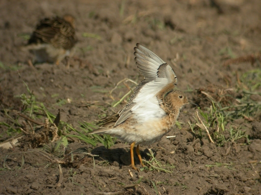
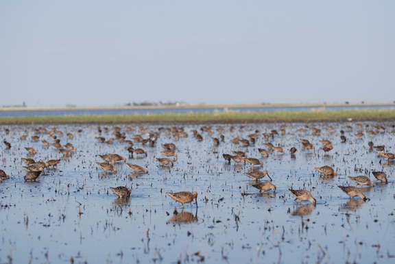
22,000 to 78,000 Buff-breasted Sandpipers—or roughly the estimated world population—stopover during spring migration.
Birds
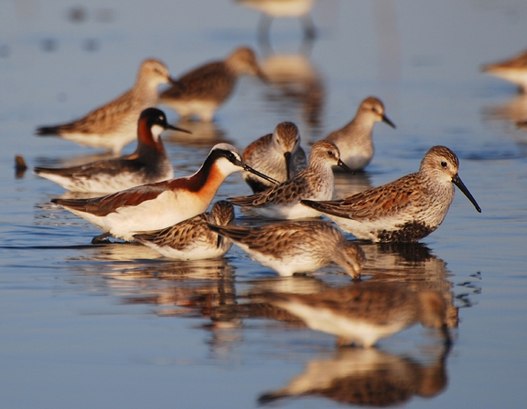
This landscape is an important stopover site for many shorebird species. Most notably, 22,000 to 78,000 Buff-breasted Sandpipers—or roughly the estimated world population—stopover during spring migration. They, along with American Golden-Plovers and Upland Sandpipers, primarily occur in agricultural fields during migration. The region also harbors as many as 100,000 breeding Killdeer. Other migrating shorebirds use the landscape’s wetlands in large numbers, such as White-rumped Sandpiper, Long-billed Dowitcher, Wilson’s Phalarope, Baird’s Sandpiper, and Stilt Sandpiper.
The Rainwater Basin is also an important stopover site for waterfowl and other waterbirds. Its wetlands annually host 7 to 14 million ducks and geese (LaGrange 2005). This figure includes approximately 90% of the Greater White-fronted Goose, 50% of the Lesser Snow Goose, 50% of Mallard, and 30% of Northern Pintail mid-continental populations. Wetlands in western portions of the region routinely host the critically-endangered Whooping Crane, with approximately 60 modern-day records. Overall, 340 bird species have been recorded in the Rainwater Basin region.

Threats
Exposure to pesticides and potentially compromised food resources [quality/quantity] on agricultural lands are concerns for migratory species such as the Buff-breasted Sandpiper and for breeding species such as the Killdeer and Upland Sandpiper. Threats to the landscape, and specifically wetlands, include conversion to agriculture, siltation of wetland basins due to agricultural run-off, water diversion, and invasive species. In many cases, it is the cumulative impacts of several or all of these factors that reduces the function of the wetland and the value to shorebirds.
Habitat Management
Management of public wetlands and uplands has become increasingly sophisticated and effective. Restoration and enhancement are often the foundation for improving wetland habitat, and specific actions include filling in excavated pits that concentrate water, plugging surface drains, removing sediment accumulated from run-off, and removing trees. While broad-scale restoration is generally a one-time event, other management activities are employed with a greater frequency to maintain habitat and to reduce invasive species. These actions mimic disturbance regimes that occurred naturally and include prescribed burning and grazing treatments. Agricultural habitats, which are used by Buff-breasted Sandpipers, are not actively managed for shorebirds, but certain farming regimes appear to provide necessary habitat composition and resources.
Resources
Recent shorebird studies have included research of both wetland and upland habitats. E. Brennan studied local and landscape variables affecting shorebird (and waterfowl) abundance at Rainwater Basin wetlands. J. Jorgensen, J. McCarty, and L. Wolfenbarger have studied primarily upland shorebird use of agricultural fields since 2004. Buff-breasted Sandpiper has been a primary focus of their efforts and they have published recent papers in the Condor and Wader Study Group Bulletin. A complete list of relevant shorebird documents follows:
- Brennan, E.K. 2006. Local and landscape level variables influencing migratory bird abundance, diversity, behavior, and community structure in Rainwater Basin wetlands. Ph.D. dissertation, Texas Tech University. Link (pdf)
- Drahota, J. 2003. Breeding Black-necked Stilts at Funk Waterfowl Production Area. Nebraska Bird Review 71: 166.
- Farmer, A.H., and A.H. Parent. 1997. Effects of landscape on shorebird movements at spring migration stopovers. The Condor 99: 698-707.
- Jorgensen, J.G. 2007. Buff-breasted Sandpiper (Tryngites subruficollis) abundance, habitat use, and distribution during migratory stopover in the Rainwater Basin, Nebraska. M.S. Thesis, University of Nebraska at Omaha.
- Jorgensen, J.G. 1997. Shorebird migration in the Eastern Rainwater Basin- spring 1997. Nebraska Bird Review 65: 133-135.
- Jorgensen, J.G., and P. Dunbar. 2005. Multiple Black-necked Stilt nesting records in the Rainwater Basin. Nebraska Bird Review 73: 115-118.
- Jorgensen, J.G., J.P. McCarty, and L.L. Wolfenbarger. 2008. Buff-breasted Sandpiper Density and Numbers During Migratory Stopover in the Rainwater Basin, Nebraska. The Condor 110: 63-69.
- Jorgensen, J.G., J.P. McCarty, and L.L. Wolfenbarger. 2007.. Landscape and habitat variables affecting Buff-breasted Sandpiper (Tryngites subruficollis) distribution during migratory stopover in the Rainwater Basin, Nebraska, USA. International Wader Study Group Bulletin 112: 45-51.
- Jorgensen, J.G., J.P. McCarty, L.L. Wolfenbarger, M. Ealy, and B. Ortego. 2006. Buff-breasted Sandpiper abundance, distribution, and habitat use in the Rainwater Basin, Nebraska and Texas [Abstract]. Wader Study Group Bulletin 109: 21
- Jorgensen, J.G. 2004. An Overview of Shorebird Migration in the Eastern Rainwater Basin, Nebraska. Nebraska Ornithologists’ Union Occasional Paper No. 8. 68 pages.
- Morris, L. 1970. Whimbrel and Dunlin. Nebraska Bird Review 38: 17.
- —–1978. Buff-breasted Sandpipers. Nebraska Bird Review 46: 77-79.
- —–1995. Buff-breasted Sandpiper. Nebraska Bird Review 65: 60.
- Swenk, M.H. 1915. The Eskimo Curlew and its disappearance. Annual Report of the Smithsonian Institution for 1915: 325-40.

