


Deveaux Bank
Location
United States, South Carolina
Category
International
Basis for Designation
At least 25% of the entire North American population of Whimbrels.
Significant Species
Whimbrel (Numenius phaeopus)
Red Knot (Calidris canutus rufa)
Size
247 acres (100 ha)
Date Designated
July 2024
Responsible Entity
South Carolina Department of Natural Resources
Contact
Felicia Sanders
South Carolina Department of Natural Resources
Context Map

Overview
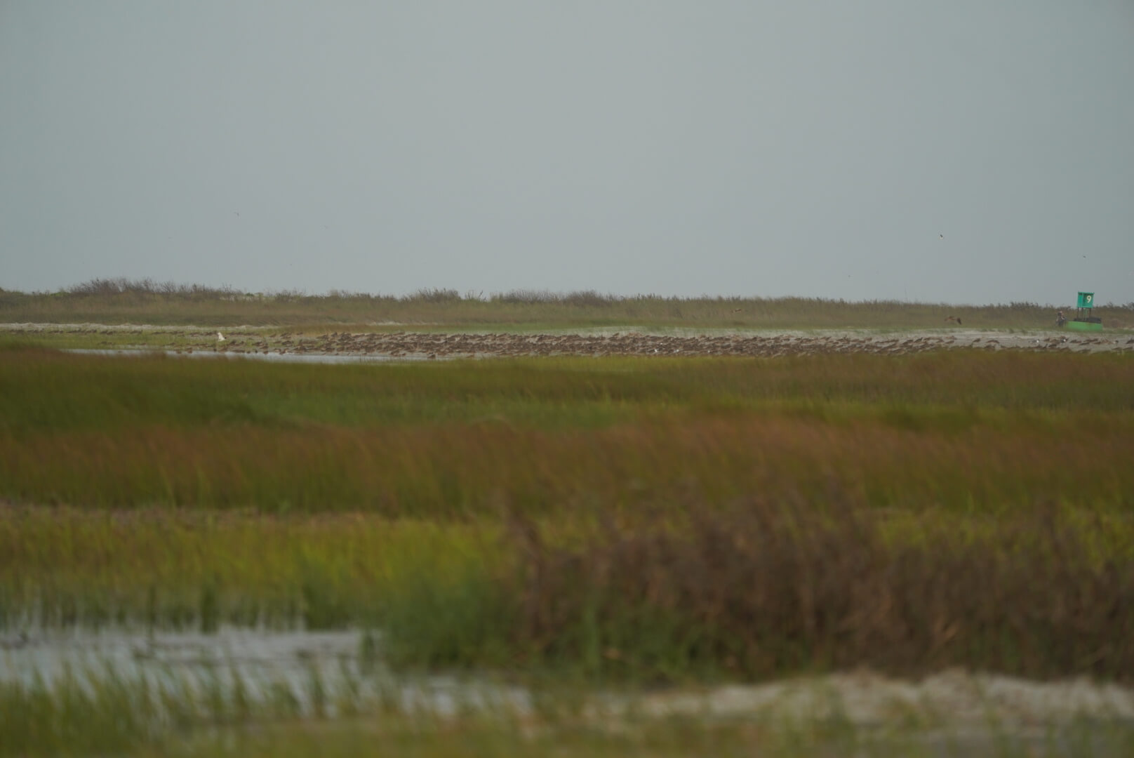
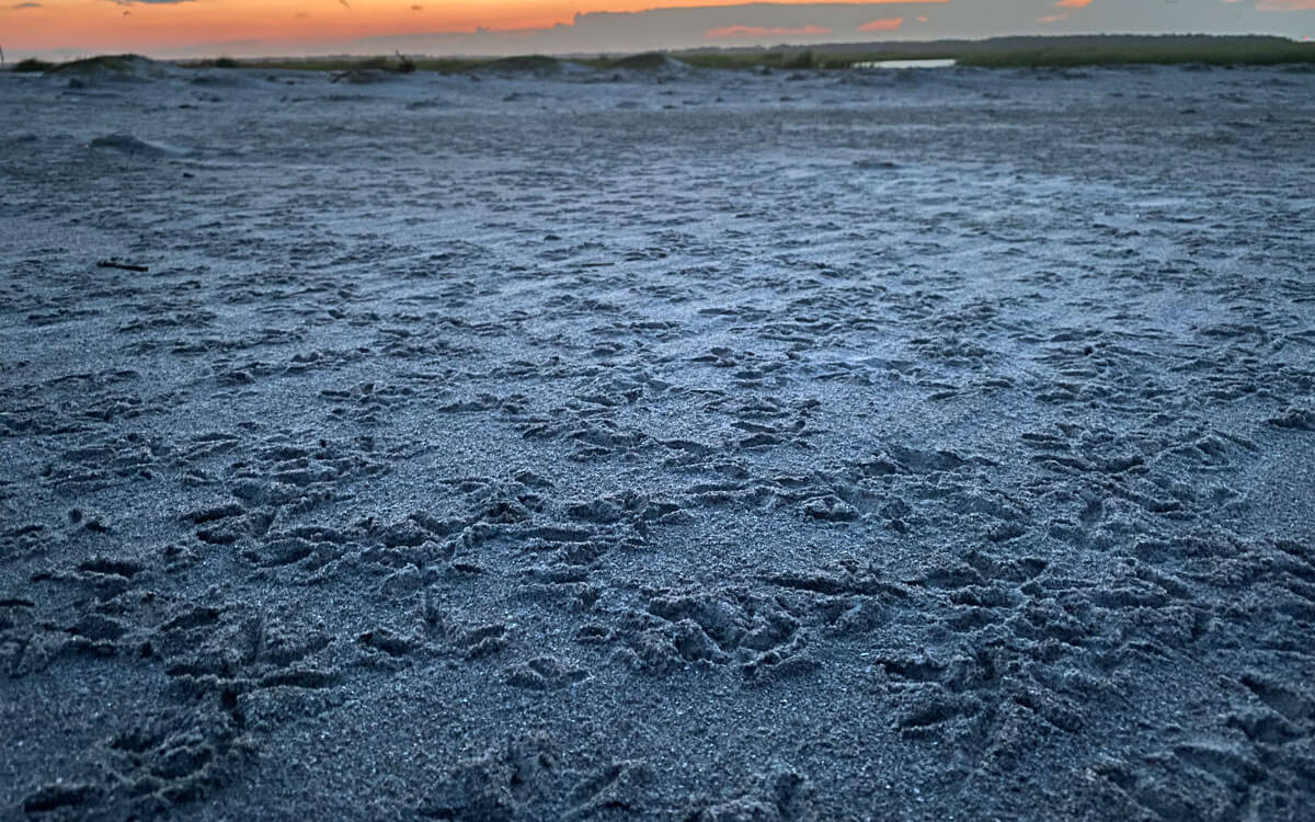
Deveaux Bank is an ephemeral, horseshoe-shaped, uninhabited island at the mouth of the North Edisto River, located along the coast of Charleston County in South Carolina. The island covers approximately 247 acres (100 ha) at low tide, but it is constantly shifting and changing in a cycle of erosion and accretion. It has tidal saltmarsh habitat in the interior of the island, intertidal shoals surrounding the island, and approximately 2.3 miles (3.7 km) of sandy beaches on the edges of the island. The average elevation on the island is 3.3 feet (1 m), with areas completely submerged during high tide, leaving approximately 64 acres (26 ha) of dry roosting area for shorebirds and other waterbirds.

Aerial view of Deveaux Bank. Photo: Andy Johnson.
Importance to shorebirds
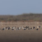
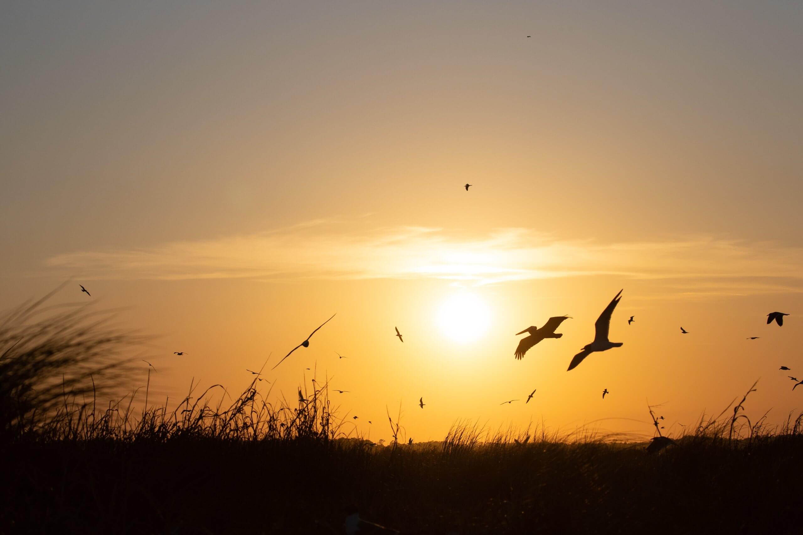
Historical data from the International Shorebird Survey (ISS) as well as more recent research have shown that Deveaux Bank is an important area for shorebirds throughout the year. A total of 27 shorebird species have been recorded using the area either for breeding, roosting, feeding, wintering or as a stopover site during migration. Large numbers of species of concern like the Whimbrel (Numenius phaeopus) and the federally threatened Red Knot (Calidris canutus rufa) use the sandbar for roosting and feeding, whereas species like the Wilson’s Plover (Anarhynchus wilsonia), Willet (Tringa semipalmata), American Oystercatcher (Haematopus palliatus) and, occasionally, Killdeer (Charadrius vociferus) and Black-necked Stilt (Himantopus mexicanus), can be found breeding on the beaches and in the low vegetation.
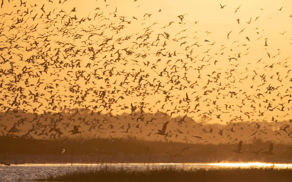
In 2014 Felicia Sanders of the South Carolina Department of Natural Resources (SCDNR) discovered a large nocturnal roost of Whimbrel at Deveaux Bank. To learn more, Deveaux Bank was visited in following years during the evening in the months of April and May, and large roosting flocks with over 10,000 Whimbrels were observed in May 2018. Follow-up surveys carried out during 2019 and 2020 revealed that Deveaux Bank supported at least 19,485 roosting Whimbrel during peak spring migration. This is the largest nocturnal roost known for this species and these counts represent 25% of the entire North American population (80,000; Andres et al. 2012).
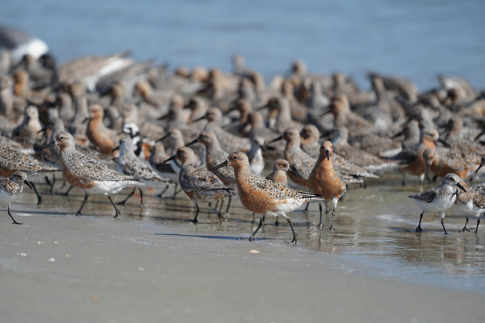
Deveaux Bank also appears to be of significant importance to migrating Red Knots on their springtime migration. A total of 17,247 Red Knots have been estimated passing through the area February-May 2021 and probably roosting at night at Deveaux Bank (Pelton et al, 2021). This number would qualify the site as a site of Hemispheric Importance, but it was argued that this high number is not an actual count, and better documentation is desired. Nonetheless, on April 8, 2021, 4,000 Red Knots were counted on Deveaux Bank (eBird). Considering the entire rufa Red Knot population, this would represent nearly 10% of this biogeographic population. Beyond doubt the area is also of critical importance to the species as well and will benefit from the designation.
Shorebird research
Research is being carried out by PhD student, Maina Handmaker, from the Senner Lab at the University of Massachusetts Amherst, who investigates the role nocturnal roost sites play in the stopover ecology and migratory performance of Atlantic flyway Whimbrel. By tracking Whimbrel movements during and after their migratory stopovers on the coast of South Carolina, Ms. Handmaker is investigating how individuals select foraging and roosting sites and working to better understand how those choices influence their entire annual cycle.
Conservation
Deveaux Bank lies on the northeastern edge of the Ashepoo, Combahee and Edisto Basin (ACE Basin), which is a 350,889.642 acre (42,000 ha) multi-use conservation area and one of the largest wetland estuarine systems on the Atlantic coast of the U.S. The designated area as a WHSRN site is a Seabird Sanctuary and Heritage Preserve (S.C. Code 50-11-860) owned and managed by the South Carolina Department of Natural Resources (SCDNR). Besides, Deveaux Bank is designated as an “An Important Bird and Biodiversity Area” (IBA) in South Carolina for its importance as a breeding site for several (colonial) waterbirds. The boundaries of the WHSRN site are the same es those defined for the IBA.
Threats and management priorities
Deveaux Bank is located within Charleston County, which has a growing population of nearly half a million residents. It is just 0.6 miles (1 km) from Seabrook Island, a vacation destination. Its sandy beaches are popular for fishing and swimming, and human disturbances include beach recreation, dogs, and plane and helicopter flyovers.
The site’s status as a Seabird Sanctuary and Heritage Preserve allows SCDNR to close portions of the island to trespassing to the low tide line. Since 2014, most of the island’s beaches have been closed during spring and summer to protect migratory and nesting birds. Although dogs and camping are prohibited, enforcement is needed for compliance, and these rules and regulations must be renewed every five years.
The site has an active Seabird Sanctuary and Heritage Preserve Management Plan, which was published as recently as 2022. Several regulations herein make sure that human disturbance is managed, including that:
- No dogs are allowed at any time on the island.
- No camping is allowed at any time on the island.
- Seasonal closures are in place to prevent disturbance to shorebirds during migratory and breeding seasons.
- No motorized vehicles or bicycles
The management plan further states that Deveaux Bank will be posted with location identification and shoreline signs to indicate seasonal closures and openings. Signs, with site specific rules and regulations (listed above), will be placed on wooden posts at the waterline to inform the boating public. Buoys in the intertidal zone will also be placed, as needed, to mark closure boundaries. Natural history educational signs may also be placed at key areas on the islands and local boat ramps.


